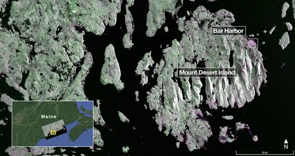
NASA and India’s ISRO have released the first radar images from their joint NISAR satellite, just weeks after its launch from Sriharikota on July 30, 2025. The mission, short for NASA-ISRO Synthetic Aperture Radar, sent back views of Mount Desert Island in Maine on August 21 and farmland in North Dakota two days later.
Scientists say the data shows how the satellite can track land, crops, forests, and water with clarity unmatched by other Earth-observing missions.
NISAR is the first spacecraft to carry two radar systems at once. NASA’s L-band radar can detect deep changes in soil, ice, and forests, while ISRO’s S-band radar is tuned for monitoring crops and smaller vegetation. From its orbit 747 kilometers above Earth, NISAR scans nearly the entire planet every 12 days.
Its 12-meter antenna, the largest NASA has launched, captures swaths 240 kilometers wide and can spot features as small as five meters. Unlike optical satellites, it works day or night and through cloud cover.
The first images highlight what the system can do. In Maine, forests appeared in green, water in black, and buildings in magenta. In North Dakota, radar distinguished wetlands, forests, bare soil, and irrigated farmland, even showing circular crop patterns.
Scientists say this ability to separate surface types will help track floods, droughts, deforestation, and melting ice, as well as measure ground shifts from earthquakes or landslides down to a centimeter.
The mission represents nearly a decade of work between NASA’s Jet Propulsion Laboratory and ISRO. India provided the S-band radar, spacecraft bus, and launch on its GSLV-F16 rocket, while NASA contributed the L-band radar, antenna, and communications systems. Engineers on both sides say the successful deployment of the satellite’s antenna in orbit was a key milestone.
NISAR is now in its commissioning phase, with full operations set to begin in November 2025. Once active, it will deliver open-access data for researchers worldwide. Scientists expect it to become one of the most detailed Earth-monitoring tools yet, helping governments and communities respond to disasters, manage resources, and understand climate change.
Leave a Reply