India successfully launched the NASA-ISRO NISAR satellite on July 30, 2025, at 5:40 PM IST from the Satish Dhawan Space Centre in Sriharikota, Andhra Pradesh. The mission lifted off aboard the GSLV-F16 rocket.
The NASA-ISRO Synthetic Aperture Radar (NISAR) mission is a joint project by the Indian Space Research Organisation (ISRO) and NASA.
It’s built to change how we observe Earth by collecting detailed data on land, ice, and vegetation. Scientists will use this information to monitor natural disasters, track changes in climate, and study farming patterns.
The countdown began at 2:10 PM IST on July 29, with ISRO confirming that final preparations were underway. NISAR is one of the most advanced satellites ever made for studying Earth. It carries two Synthetic Aperture Radars (SARs) that work at different radio frequencies—L-band and S-band.
This is the first time a satellite has used both together. These radars can see through clouds, rain, and darkness, capturing clear images of Earth’s surface every six days at each point and globally every 12 days.
| Feature | Details |
|---|---|
| Satellite name | NISAR (NASA-ISRO Synthetic Aperture Radar) |
| Launch date | July 30, 2025 |
| Launch time | 5:40 PM IST |
| Launch site | Sriharikota, India |
| Launch vehicle | GSLV-F16 |
| Orbit altitude | 747 km |
| Weight | 2,393 kg |
| Data output | ~80 terabytes per day |
| Mission cost | $1.5 billion (NASA: $1.16B, ISRO: $90M) |
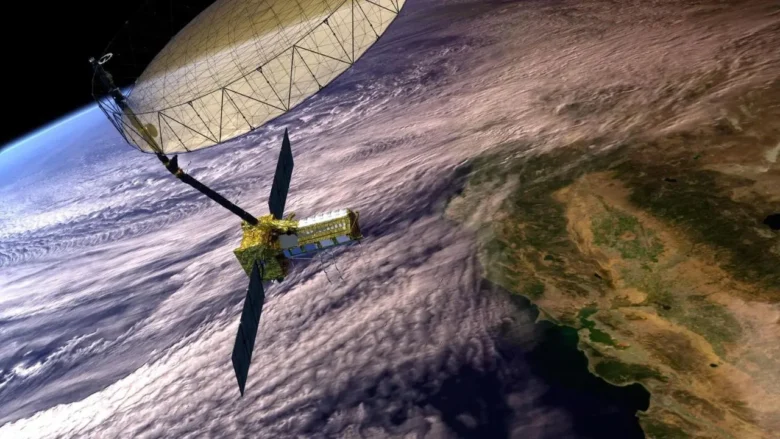
A Unique Dual-Radar System
What sets NISAR apart is its use of two radar systems on the same satellite. Radar works by sending out microwave signals and collecting the echoes that bounce back. In space, SAR technology allows these systems to function like large ground-based radar antennas. NISAR’s 12-meter antenna, provided by NASA, can produce images as clear as those from a 20-km-wide ground system.
The L-band radar can detect changes beneath tree cover, sand, or ice. This makes it useful for mapping forests and measuring the amount of carbon stored in them. The S-band radar focuses on wider features like fields and water bodies. It can monitor the growth of crops such as sugarcane or soybean, especially in India. These two systems work together, capturing the same area at the same time from different angles. This provides a level of detail not possible with a single radar.
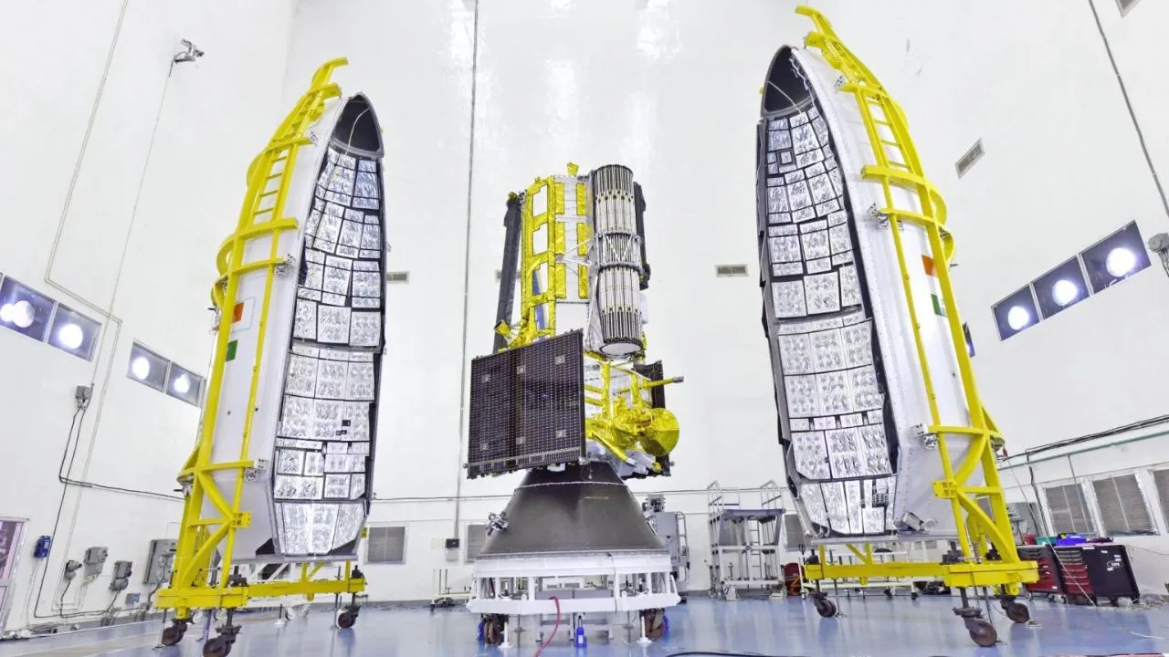
The satellite is expected to generate about 80 terabytes of data each day, three times more than any previous satellite in its category. Placing two different radar systems on one platform required careful planning to prevent interference between their signals. This is one of the reasons the satellite took more than 15 years to complete.
A Milestone in India–US Collaboration
NISAR is the first satellite developed jointly by ISRO and NASA. The idea began in 2007, when NASA proposed a mission to study how Earth’s surface is changing. ISRO officially joined the project in 2012, contributing its own research goals. NASA supplied the L-band radar, GPS systems, and the 12-meter antenna, spending around $1.16 billion. ISRO provided the S-band radar, the GSLV-F16 rocket, and launch support, contributing about $90 million.
The mission builds on earlier collaborations between the two space agencies, such as NASA’s instrument on ISRO’s Chandrayaan-1 lunar mission. Today, NISAR reflects growing cooperation between India and the US in space research. Both agencies will manage and share satellite data from their ground stations.
Applications and benefits
NISAR will provide centimeter-level accuracy in observing changes across Earth’s surface. Its data will be useful for:
- Mapping land shifts caused by earthquakes, landslides, or volcanic activity
- Tracking ice sheet movements in Antarctica and Greenland
- Measuring forest biomass and deforestation in the Amazon and other regions
- Monitoring crop development and estimating yields in Indian agriculture
- Supporting disaster response efforts with timely satellite imagery
All collected data will be freely available to researchers and institutions around the world.
The GSLV-F16 Rocket
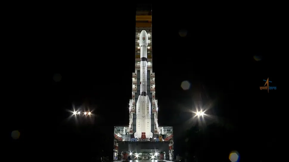
The GSLV-F16 is a 51-meter-tall rocket that weighs about 420 tons. It’s designed to carry large satellites like NISAR. The rocket has three stages: a solid-fuel core, four liquid-fuel boosters, and an upper stage powered by cryogenic fuel. India’s cryogenic engine technology, once imported, is now developed locally and has shown strong performance with over 80% success in recent launches.
At liftoff, the solid stage and boosters fire first, followed by the cryogenic stage, which places NISAR into a 747-km orbit. Once in space, the satellite’s antennas will unfold and begin operating.
Development and Cost
NISAR took more than 15 years to develop. The project faced several delays, especially during the COVID-19 pandemic. One of the biggest technical challenges was combining two different radar systems without causing signal problems. The mission cost about $1.5 billion, with the bulk of the funding from NASA. Despite the cost, the scale and quality of data NISAR will provide makes it one of the most capable Earth-observing satellites ever launched.
NISAR’s launch marks a turning point for Earth observation and international space cooperation. It’s expected to become an important tool for researchers, governments, and emergency teams around the world. Whether it’s tracking glacier loss, mapping farmlands, or spotting floods, NISAR will help people understand and respond to changes on our planet.
ISRO will stream the launch live starting at 5:10 PM IST on July 30. All eyes will be on Sriharikota as NISAR begins its mission to study Earth in new detail.